Day 3 in Dominica: Valley of Desolation and Boiling Lake

I woke up extra early today to have coffee and fresh fruits at the restaurant before an ungodly start of 7:30am to our Valley of Desolation and Boiling Lake hike. Because most of the guests signed up to hike, yoga was cancelled.

I had asked Joanne in the kitchen last night to boil two eggs for me in the morning. Joanne being Joanne asked her staff to cook three for me. I ate two with my breakfast and packed the third with the lunch we signed up for: an assortment of peanut butter and jelly, cheese and tuna-cucumber sandwiches. We each asked for three sandwiches apiece with their homemade granola bars; we had no idea the 8-hour hike was going to make us more hungry than usual. By mid-day, we were exchanging sandwiches; begging for someone else’s PB&J and trading in granola bars.

The long drive through Dominica’s curvy road made me queasy so I was glad that we immediately started our hike from the parking lot when we arrived at 9:30am. I began to appreciate Jungle Bay’s early start to our days. We always arrived at popular hikes before anyone else, which made it seem like we were the only ones in the paths except for the occasional Germans who were stereotypically super fit and seemed to always be in a race for gold.

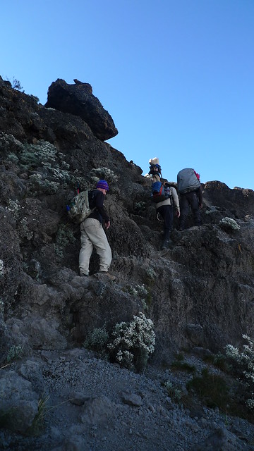
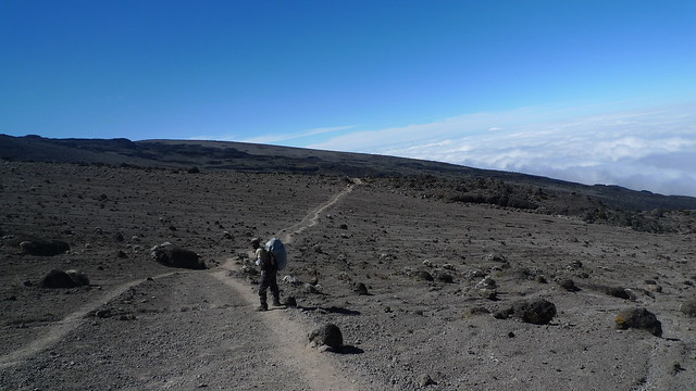
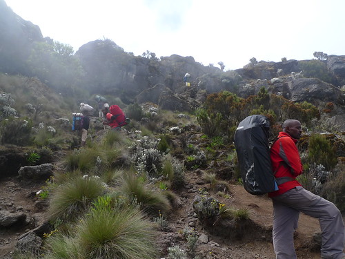
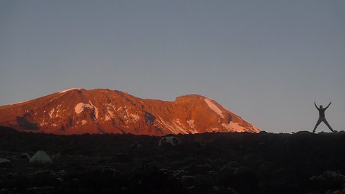
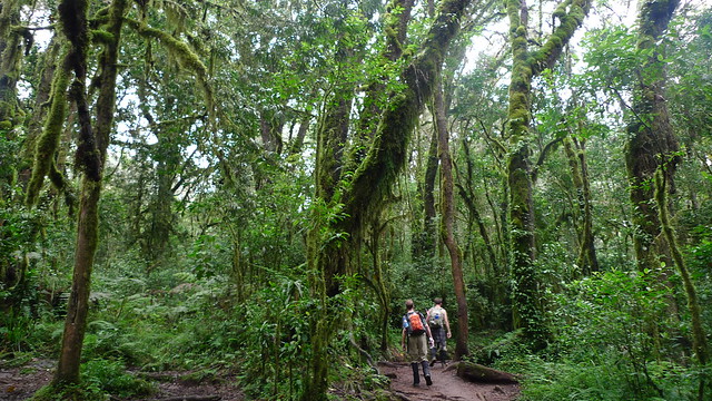
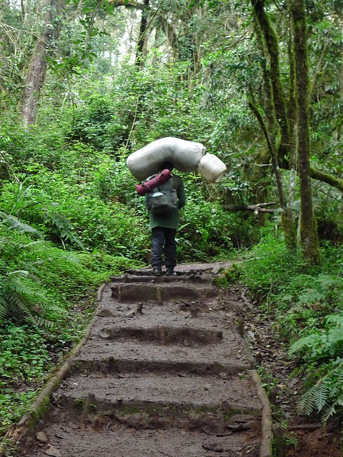
We trekked through the rain forest during the first two hours of our hike. Its lush surroundings reminded me of my first day in Kilimanjaro. Moss and vines hung from giant Banyan trees; wide elephant ear leaves and palm fronds formed canopies that barely let the sunlight in. Most of the path was muddy and quite slippery because of the constant moisture, so a lot of time and care were taken while we walked. We reached a flat top by lunch time. The view from high up was pretty unreal. It was drizzling a tiny bit but it was a welcomed respite from the forest’s humidity.

We could see the canyon which reminded me of Kauai’s Waimea. The earth was so red, a perfect contrast against all the greenery.

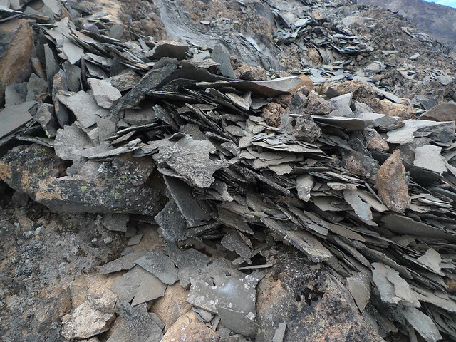
We stepped on steep steps made of bamboo logs down to the Valley of Desolation where we crossed over steaming streams that smelled like sulphur, hopped on iron-dotted red rocks and held on to slimy boulders for support. Whenever we came across running water, we gloriously refilled our drinking bottles.

When we finally made it to the Boiling Lake, Iceland came to mind. In the middle of the lake, vigorously boiling water proved that the volcano was still very active. There was a small waterfall on the side that just made the place surreal. Our group took another break while we ate our remaining sandwiches–I finally got to eat my boiled egg.

I was amazed at how one country would bring to mind my past three travels. Dominica has so much to offer and I wondered how it’s still under most people’s radar.

On our hike back, I remembered the small pool of water during one of our crossings. Sam had told me the night before that we could take a quick dip if we had time, and since I was hiking ahead with the three youngest participants of our group, we undressed to reveal our swimsuits underneath and jumped in. The rest of our group joined us a few minutes later and we all took turns under the small waterfall. We passed by a hot spring next, and feeling refreshed from our first swim, we all undressed again and slithered in. The hot water from the volcano was therapeutic but I much preferred the cold shocking water because I was hot during most of the hike. Our guide, Carlos, couldn’t really stop the adults-turned-children from making the unscheduled stops. We all knew we still had hours to go and that we had to be at the parking lot before it got dark, but we were all just having too good of a time not to jump in every pool of water we came across.

My massage appointment was moved since we were an hour late returning to Jungle Bay. I took a quick shower in my room before I subjected myself to an hour-long aromatherapy massage. My legs didn’t hurt after the hike, but my body certainly still appreciated the kneading.

I began to think that Christmas and my birthday won’t be so bad after all.

Related post/s:
Day 3 in Dominica photos on Flickr
Day 2 in Dominica: Victoria Falls
A summary of Dominica photos using Instagram

Hiking Kilimanjaro Day 4: Barranco Camp to Barafu Hut

We scaled Barranco Wall using mostly our hands to hoist ourselves up. It reminded me of my days bouldering in the city gym on 59th Street: hands getting rough and calloused just to get to the top only to come back down again, all without chalk, harness or someone belaying below. The path was sometimes narrow and dangerous; one misstep would make rocks crumble beneath our feet and remind us how high we’ve gone up in only two hours. But the hike was more challenging than it was difficult and I didn’t feel any more of the tingling sensation in my fingers and toes. I felt like I’ve acclimatized with the high altitude.

At the top of Barranco Wall, we were above the clouds. It was exhilarating to get to the top, not realizing the “top” we were aiming for was still another day away. Unfortunately, we couldn’t stay too long to enjoy the view–Karanga Valley was waiting. For the next three hours, we were on a one-lane trek to our lunch point. Everything ahead of us was flat and desolate. There weren’t any more of the giant trees, only paper-thin everlasting flowers and plants that smelled like thyme. It was very hot and very dry. I could feel the sun beating down on my shoulders and scoring a mark under my tank top. My pants and boots were covered in desert dust even before lunch time.

At Karanga Camp and 12,893 feet later, we took a break and ate watermelon and fries. The sun was even more intense up there where we all laid out our top-layer shirts on rocks to dry them off. Named after the Swahili word for “peanut”, Karanga is also the last water point before the summit. It is so named because the water from the melting glacier atop Kibo runs through the valley and provides for the peanut plantation down below. We saw several porters collect water from the river, hike past us and return to get some more. From this day on, we must conserve water until the next camp. Tonight, there will be no washing of face, hands and feet and we must sleep with the whole day caked on us.

The volcanic gravel turned into shards of sharp rock on the way up to Barafu Hut. There were huge boulder formations where hikers ahead of us stacked up small pieces of rock for good luck. We did our part and hoped for the best. The weather change dramatically, too. It got colder as we moved higher up and an ominous bank of dark clouds covered what we were about to scale and what we left behind.

A total of eight long hours of walking later, we reached 15,200 feet at Barafu Hut where we witnessed a small group of hikers and porters surround a guy who had an oxygen mask on. Though it made me feel secure that someone actually had an oxygen tank this high up in Kilimanjaro, I realized that we could be in the same position by tomorrow morning.

I was anxious during dinner and was even more nervous the rest of the night. I wore everything I packed to bed because it was so cold. In three hours, we will wake up in the middle of the night to start climbing the summit with little time to get ready for what would be the most difficult thing I’ve ever had to do in my life: hike in the dark for another eight hours to finally catch a most breathtaking sunrise on top of Africa’s highest peak.

Related post/s:
Hiking Kilimanjaro Day 4: Barranco Camp to Barafu Hut photos
Hiking Kilimanjaro Day 3: Shira Camp to Barranco Camp

Hiking Kilimanjaro Day 3: Shira Camp to Barranco Camp

I was inside my tent by 8pm last night and tried to listen to a podcast before going to sleep, but I ended up passing out a few minutes later still wearing my jacket, fleece and head scarf. My sleeping bag is really warm and I usually end up sleeping stripped down when camping, but I guess I underestimated how cold it really was in Barranco Camp that I woke up in the morning still completely dressed.

I ate two portions of porridge for breakfast to try and support the Diamox in my system. I didn’t feel ill at all but the tips of my fingers and toes were definitely tingly. We had a very long hike to Lava Tower and I was definitely catching my breath the first three hours. The landscape was open but everyone trekked in a single file to keep apace and to ensure we weren’t going so fast. No matter how much I reminded myself pole-pole, my lungs felt how thin the air was.

Lava Tower didn’t look much when we were approaching it, but as soon as we rounded a bend it mightily stood over us. For the first time in our hike, we saw a running trail of glacial water coming from Kibo. There was unfortunately more trash on the trail because the route meets with the more popular Marangu Route and the path climbers use to scale Kibo.

We had lunch in the shadow of Lava Tower. The rocks were black and sharp–we would see more of them as we escalate closer to the summit. After eating, we walked downhill and finally depended on our walking poles.

We kept stopping to take photos because the view ahead of us was just incredible. We walked by a waterfall and a beautiful ravine right under Kibo. We could see the porters cutting through another mountain ahead of us. They were like ants in one file with heavy load on top of their heads. I was grateful for their help; I couldn’t have hiked this high if I had to carry more than 3 liters of water and my change of clothes for the day.

Closer to Barranco Camp, the landscape started to look like the moon–barren and eerie with these giant trees that looked like Where the Wild Things Are feet. Samuel told us that the taller ones were at least 150 years old. There were also these succulent plants that were wet and cool to the touch. They turned out to be anti-freeze plants. It was cool to put your hands in between the aloe-like layers and feel the cold sensation in your fingers.

Samuel pointed at the gray wall to our left when we were approaching Barranco Camp. That’s Barranco Wall, he said, and we will climb that tomorrow morning. Through where? I asked, because I couldn’t see a trail that led up to it. He just waved his hand up to say, Just up.

Related post/s:
Hiking Kilimanjaro Day 3: Shira Camp to Barranco Camp photos
Hiking Kilimanjaro Day 2: Machame Camp to Shira Camp

Hiking Kilimanjaro Day 2: Machame Camp to Shira Camp

Our first breakfast in Kilimanjaro consisted of omelets, hot dogs and fresh mango. I drowned myself in instant coffee because I knew my jet lag will kick back in later. Samuel and the crew waited for the three of us to pack which took about two more hours than originally planned. They let us linger then because in the next few days, waking up at 11pm to hike for eight hours will mean waking up, really, at 11pm to hike for eight hours.

From Machame Camp, the path was up, up and up! Godibless walked in front of us to make sure we wouldn’t go any faster. The trek was narrow and filled with everyone who was at camp the night before, so it was difficult to forge ahead even if we wanted to. The porters were also on the same path and we got used to stepping aside whenever we heard Jambo!

As we increased altitude–2,642 feet total–more flowers started to appear and from the top of large boulders, we saw the progress we made in just three hours. The mist let up and Kibo showed herself again with her snow-capped top. Samuel confirmed that there was definitely more snow ten years ago.

From our lunch spot, we could see Shira Plateau, the namesake of the next camp and the second peak in Kilimanjaro National Park. To her left was Meru Peak shrouded by pillowy clouds. It was a crazy view to behold while we ate Majengo’s packed lunch for us: fried chicken (God bless him!), a coleslaw sandwich, banana and mango juice.

The remaining two hours of the day’s trek were on smaller rocks but flat land. Along the way, we couldn’t help but pick up garbage other trekkers have left behind. The thought that even Kilimanjaro travelers would even think of throwing garbage on the ground appalled me. Aren’t we more educated and sophisticated travelers than this? Hikers who don’t care for their environment shouldn’t be really allowed to hike any more. For the next few days, I came to hate one particular brand of candy in yellow-blue foil wrapper.

It was cooler up in Shira Camp. It didn’t just feel like we were above the clouds–we were actually above the clouds! The camp was flat and open, and thankfully, the porters picked a spot where our tents were far away from everyone else’s. We later found out that they all know Samuel’s preference when selecting the group’s spot for the night and it’s almost always away from the riff-raff. I liked our main guide even more after I heard this.

While waiting for dinner, the three of us walked around the camp. We had heard about a cave that was used as a sleeping spot until the park rangers officially closed it. It was disappointingly small and did not look like a cave at all, but the walking at least helped us kill time until sunset.

Do people get tired of watching the sun set when they travel? I always expect that I would, but Mother Nature never ceases to amaze me. Shira Camp was blanketed in orange and some deep purples while the clouds moved fast in the valley below us. Yet again another beautiful setting before we had to eat pumpkin soup and pasta with beef tomato sauce. That night, I ended up sleeping for twelve hours, a good night’s rest before the Diamox altitude medication started to kick in.

Day 2: Machame Camp (9,842 feet) to Shira Camp (12,467 feet)
Altitude gain: 2,645 feet
Miles: 6
Time: about 5 hours from ~9:30am to 2pm

Related post/s:
Hiking Kilimanjaro Day 2: Machame Camp to Shira Camp photos
Hiking Kilimanjaro Day 1: Machame Gate to Machame Camp

Hiking Kilimanjaro Day 1: Machame Gate to Machame Camp

I was anxious, but felt ready.

We said good-bye to the Karama Lodge staff in Arusha where Scott and I have been staying for two nights. Christopher came in the night before during the England-Germany World Cup game and made our hiking trio complete. It took a year to plan this. I invited about ten people, but unfortunately, they dropped off one by one as the date got closer. I couldn’t have asked for more mature travel partners than Scott and Christopher. (I didn’t say old!) For three people to meet in Tanzania and share amenities when they have never traveled together before and still get along afterwards is a stunning feat in itself. Hiking the highest free-standing mountain in Africa (and in the world! Thanks, Scott!) and making it to Kibo’s summit was just icing on the cake. The others missed an unforgettable trip.

We were in a small Tropical Trails bus to Moshi with our main guide, Samuel, and the rest of our wagumu, our porters, or “strong men” in Swahili: Majengo, Peter M, Nicodemus and our assistant guide, Godibless. A second but shorter Peter will meet us at Machame Gate with Anton, Komoyi and Puzizi, making our six-day group a total of twelve. (Every time we met up with the porters during our trek, I cheered Puzizi! I loved saying that name!)

After a two-hour ride with a stop at the butcher for meat, we arrived at the starting point of our route. There were several hiking groups already there, most we’ll recognize and greet throughout our ascent. Locals waited outside the gate for last-minutes shoppers. They sold gaiters, ponchos and hats. Scott managed to get used hiking poles for $15!

We registered with our names and passport numbers and waited for our guides to weigh all our gear. Hiking in Kilimanjaro requires a licensed guide, and everything you carry and weigh in, you must carry and weigh out including garbage. Contrary to popular knowledge, Kilimanjaro is made up of three peaks: Kibo, Meru and Shira, the first being the most popular and thus referred to as the Kilimanjaro. (For the purpose of accuracy, I mention Kibo in all my posts and photo captions when referring to the summit itself and Kilimanjaro for the entire national park.)

We left the gate and started our hike at 12:30pm through Machame’s lush rain forest. Godibless hiked with us while Samuel stayed behind to make sure the porters had everything in order. For the next six days, we’d either hike with Samuel or Godibless, or both would flank the three of us on the trail. I imagine it was for a case when someone has to descent–the other guide can stay with whoever still feels good about continuing to the summit. This way, if one got sick, the rest of the group may continue.

Vegetation gradually changed as we ascended and because we were exerting effort, we had peeled our layers off down to a shirt. It would get cool again whenever we stopped for a break and a long-sleeved left around my neck would go back on. We took one long stop to eat the lunch that Majengo, our cook, had packed for us. We learned our first useful Swahili word: pole-pole, pronounced poh-lay poh-lay, which means “slow down”. Every few hours, Godibless reminded us to pole-pole; to conserve our energy and take our time.

He also cheered us on and complimented us on our progress. We later learned that he was basically assessing if we will make the summit five days later. To keep our minds off the hike itself, he taught us what other guides teach their tour group: the Jambo song. We never memorized it completely and by the end of our trip, Scott and I were making up the lyrics. But it went a little something like this:

Jambo
Jambo, Bwana
Habara Gani
Mzuri Sana
Wageni, Mwakaribishwa
Kilimanjaro
Hakuna Matata

which roughly translated to:

Hello, how are you?
Very fine
You’re all welcome here
You can climb Kilimanjaro
There are no worries

and I was told that “you” referred to the white people, or in today’s parlance, the foreigners.

As we gained 4,954 feet in altitude, our surroundings turned to Tim Burton-inspired trees covered in moss, hardier ferns and yellow flowers. I was out of breath during the higher hills, but I was amazed how strong my legs felt: the past year I spent swimming alone and working out with a trainer has paid off.

We checked in Machame Camp at 5pm after eleven miles of hiking just in time for Holland to score the first goal of three against Slovakia. Our tents were not yet set up because the porters got held up at the gate. It was the coldest I would feel throughout the entire trek because all my warm clothing was still inside my bigger backpack with the porters. We tried to stay warm inside the park ranger’s cabin while we entertained ourselves by checking out the log book for the youngest (13 years) to the oldest (71 years) hiker in the same camp.

We were given a small basin of hot water each to wash up. They would end up brightening my day for the rest of the week because after several hours of hiking–and then several days without showering–washing our hands and faces was a big thing to look forward to. When the mess tent was set up, we sat inside to eat our first tea and popcorn of the week. I would never think of the combination and I rarely eat popcorn, but they always warmed us up before dinner. Our first meal was cucumber soup with some spring onions, boiled potatoes and a mix of vegetables in tomato sauce, plus battered and fried tilapia. Carrots, cauliflowers and bell peppers would appear on our plates every night that I started referring to them as quasi-mirepoix just to give the repetitiveness some class. Majengo tried to be very creative and I did not look forward to anything else but his meals at lunch and at the end of each day.

I lost my sense of time while I was in Kilimanjaro. We would retreat to our tents (Scott and Christopher shared, while I had my own!) as soon as it got dark which was probably 8 or 8:30pm. For the first couple of days, because of jet lag, I would wake up in the middle of the night to relieve myself thinking it was almost dawn. (I am now an expert in peeing in the woods because it was too much effort to walk to the outhouse.) There were times when the moon was so bright that I would think it was already morning, only to step out of my tent completely dressed up for breakfast that I would realize the stars were still out. How much longer until 7am? I caught my first glimpse of Kibo’s snow-capped peak the first night. I remember thinking, I should ask which mountain that is because I couldn’t believe that it was already visible from our first camp. Those were my solitude hours when I wrote in my journal and reflected on the day that just past. It was just me, my pen and my headlamp; they were also the loneliest hours of the trip.

Day 1: Machame Gate (4,888 feet) to Machame Camp (9,842 feet)
Altitude gain: 4,954 feet
Miles: 11
Time: about 5 hours from ~12pm to 5pm

Related post/s:
Hiking Kilimanjaro: Machame Gate to Machame Camp photos